
OUR VISION
We aim to create a global real-time map of ocean activity, and ultimately, a self-sustaining community-driven ocean monitoring system.

WHY?
The oceans are vast, yet our ability to monitor them is incomplete. We rely on AIS to see vessel movements, which leaves gaps in visibility.
This impacts maritime safety, exacerbates overexploitation of marine life, and leaves the ocean vulnerable.
To safeguard our seas, we need a real-time solution that complements AIS and together they deliver a more complete picture of ocean activity.
KAHU is a collective network where sailors, explorers, ocean lovers, as well as commercial and research vessels can contribute their radar data to build a real-time map of ocean activity.
Together, we can make our seas safer and more transparent, and protect marine life.
HOW?
Using a navigation software plug-in, radar data is securely streamed to a cloud-based platform and combined with vessel tracks detected by other participating radars, creating a live, crowdsourced map of the ocean that fills visibility gaps in ocean traffic.
WHO CAN JOIN?
KAHU is for anyone that navigates or studies the ocean and uses onboard radar. Whether you're a sailor, scientist, commercial operator, or conservationist, your radar data can help create a clearer picture of what’s happening at sea.
By joining this network, you contribute to safer waters, greater transparency, and a deeper understanding of human activity at sea.

Adventurers & Explorers

Yacht Clubs & Marinas

Commercial Vessels & Ferries

Research & Expedition Vessels
WHAT IS THE USE CASE FOR YOUR DATA?
The basic dataset will be open-source to improve maritime visibility for the community. Live data is not yet available, but we are actively collecting contributions.
Your data will support marine conservation, navigation safety, and transparency over vessel activity.
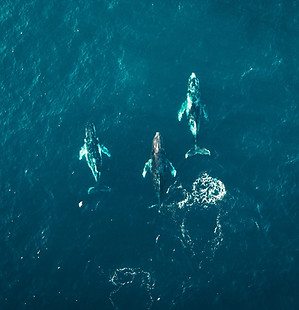
Marine conservation and environmental monitoring through more comprehensive mapping of fishing and other human activity at sea.

Improving situational awareness at sea by mapping and validating vessel positions and tracks.

Increasing maritime safety by revealing all vessel movements, without relying on AIS.
TECHNOLOGY
Our software is open-source, for transparency and collaborative innovation via peer-reviewed improvements.

Visit out GitHub page.
THE FOUNDING TEAM

BEA HRANAIOVA
Navigation
Former start-up founder and investment banker, passionate about the environment


EGIL MOLLER
Technology
GIS programmer, environmental data scientist, and a sailor committed to protecting our oceans
Are you a maritime professional interested in our mission?
We're looking for team members!
Get in touch